Malmo Airport (MMX)
Driving Directions / Travel by Car
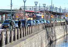
(Malmo, Sweden)
Malmo Sturup International Airport (MMX) is situated 28 km / 17 miles south-east of Malmo and is served by the 108 road and the E65 (Börringe Kyrkovag). Signposted locally as the 'Malmo-Sturup Flyplats', the airport is located off the Sodra Sturupsvagen and the Bramstorpsvagen roads.
Close to Malmo Airport, the vast Hackeberge nature reserve is located to the east, while Nötesjö, Börringe and Norra Grönby lie directly south. The journey time from Malmo to the nearby airport is roughly 30 minutes.
Directions to Malmo Sturup International Airport (MMX) from the north:
- From Helsignborg, follow the E6 south, passing though Landskrona before reaching the city
- From the city, head south-east, following signs for the airport
Directions to Malmo Sturup International Airport (MMX) from the south:
- From Trelleborg, head north towards the city of Malmo, then south-east, following signs for the airport
Directions to Malmo Sturup International Airport (MMX) from the east:
- From Kristianstad, take the E22 west, passing through Lund
- From Lund, continue south and follow signs for the airport
Directions to Malmo Sturup International Airport (MMX) from the west:
- Malmo is located on the west coast of the country, hence there are no destinations farther west of it
The main road routes into Malmo can experience some congestion during peak times of the day. Passengers are recommended to allow themselves adequate time to drive to Malmo Sturup International Airport if they are travelling during rush hours.
Malmo Airport (MMX): Virtual Google Maps
